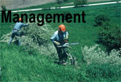
Management Plan
Richard S Rhodes IIJudith J Felder
Mary E Brown
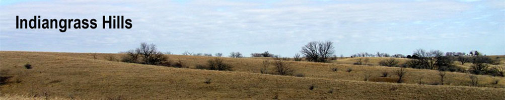
In 1997 we (RSR II, JJF, & MEB = R/F/B) purchased a 480 acre farm in Sections 20 and 21 of Pilot Township; in 1998 William and Barbara Buss joined our project by purchasing an adjoining tract of 160 acres in Section 20 (see Fig. 1). Although under separate ownership, both tracts presently are managed by us with the long term goal of restoration to resemble the environment before Euro-American settlement of Pilot Township. We have named our 640-acre project “Indiangrass Hills” in recognition of not only the rolling landscape but also the most prominent prairie component (Sorghastrum nutans) seen on our project’s remnants in the first growing season of fallowing.
Brief Civil HistorySettingIn the western part of what was to become Iowa County, Sauk and Fox title was ceded to the United States by the treaty of 11 Oct 1842 (Sage, 1974: Fig. 3.2, p. 45 & p. 71). Deputy surveyors contracted by the Surveyor General’s Office at Dubuque, Iowa, divided this ceded ground in 1843 and 1844 into congressional townships and sections to allow its sale to settlers (Dodds et al., 1943:222). The observations in these surveyors’ notes and plat maps are very useful for determining the character of the presettlement landscape (Hutchison, 1988). Iowa County was organized from the western part of then Johnson County in 1845 (Anonymous, 1881:346, 351). The first tracts in Pilot Township, those close to surface water and timber, were occupied by settlers in 1854 to 1856 (Anonymous, 1881:683-685). Pilot Township was the last civil township to be organized in Iowa County by being divided from from English Township on 4 Aug 1862 (Anonymous, 1881:622, 682, 685) and exactly corresponds to congressional township T79N, R11W of the Fifth Principal Meridian.
Presettlement BiotaPrior to Euro-American settlement, Iowa was dominated by the grasslands of the Central Tallgrass Prairie. Iowa County conformed to this dominance by prairie. Indeed the settlement of Pilot Township itself was delayed from the rest of Iowa County by lack of surface water, the absence of timber for fuel and construction, and the faulty perception that the absence of trees indicated poor soil fertility. To quote a history of Iowa County (Anonymous, 1881:309-310):
“During the early settlement of the county, that is from 1843 to 1850, while the country in the valleys of the Iowa River, Old Man’s Creek and English River were being densely populated, ... there was scarcely an inhabitant upon that wide and beautiful ridge which intervenes between the valleys of the Iowa and the English rivers [sic]; the whole region was a bleak, trackless, uninhabited waste. People thought it would never be adapted to agricultural purposes and could not be settled, owing to the scarcity of timber. It was not till 1854 that this portion of the county, ... began to be extensively settled.”Pilot Township lies on the southern side of this “beautiful ridge” and essentially was all prairie (Unknown, 1845; Andreas, 1875:146, map of Iowa County). It has an area of 23,214 acres (Anonymous, 1881:683); a perfectly regular township would contain 23,040 acres. The 1875 census of Iowa with “agriculture data” from 1874, reports that Pilot Township only supported 92 acres of “natural timber” (Iowa Executive Council, 1875). This timber probably was entirely in an upland grove near the center of the eastern boundary of the township. The grove was “... called Pilot Grove because it served as a landmark to guide the traveler across the trackless and treeless prairie” (Anonymous, 1881:682) and gave Pilot Township its name (Anonymous, 1881:682). Also noted in Anonymous (1881:683) was the observation that: “Formerly there was no timber in the township except a little grove, called Pilot Grove, ... and a very few scattering trees on North English River.” The remaining 23,122 acres (99.6%) were mapped by the 1843 & 1844 General Land Office Surveys as prairie including four small sloughs in valley heads (Unknown, 1845). Indeed, of the 90 survey stations established in John Senter’s 1844 subdivision of the township, only eight had suitable bearing trees nearby and only four of these had the desired two trees (Unknown, 193?). Of note, no valley in Pilot Township was mapped as having a timbered bottom or gallery forest. However, the North English River in English Township, just south of the south line of Pilot Township, did have a well-developed timber on its south valley wall (Andreas, 1875:146, map of Iowa County). Unfortunately, we have not yet examined J.E. Whitcher’s 1843 town line survey for Pilot Township.
Of the two sections in which Indiangrass Hills lies, the quarter section survey stations on the south and west lines of Section 20 had bearing trees. About a quarter mile to the south of Indiangrass Hills in Section 29, one 16-inch diameter “W. Oak” = Quercus alba was recorded (Unknown, 193?:349) along the south line of Section 20 but no other suitable tree occurred within about 10 surveyor’s chains (660 feet) of the survey station (see General Instructions of 1843 in Dodds et al., 1943:60). Within Section 20 along the west line, two small “Jack Oak” = Quercus species possibly Q. ellipsoidalis (now called northern pin oak) were recorded (Unknown, 193?:351): one 8-inch diameter on the Buss 160 and one 7-inch diameter to the south on our neighbor’s farm. The range description in Eilers and Roosa (1994) however, excludes this species from Iowa County. Nonetheless Easterly (1951:79) reports one specimen collected near Homestead and the county distribution map in Stein et al. (2003:25) also shows it to be present. Two other grossly different oak species have been called jack oak: Q. imbricaria (shingle oak; Gleason and Cronquist, 1991) and Q. marilandica (blackjack oak; Stein et al., 2003:58 and others), but neither occurs in Iowa County (Easterly, 1951:79; Stein et al., 2003:41, 59). Furthermore, Q. ellipsoidalis grossly appears similar to Q. velutina (black oak; Stein et al., 2003:102), and young trees or stump sprouts of black oak could have easily been confused with northern pin oak. Suggestively, today black oak is common at Indiangrass Hills, but it is doubtful that this quandary can be resolved 160 years after the initial township survey.
One of the four valley head sloughs in Pilot Township occurred on Indiangrass Hills and was noted (Unknown, 193?:352) as being three chains (198 feet) wide where it crossed the north line of Section 20. This slough was mapped (Unknown, 1845) as beginning in the center of Section 17 to the north, flowing southeastward, and ending just northeast of the center of Section 20. John Senter’s notes record that all section lines around Indiangrass Hills were “rolling 2nd. rate prairie” (Unknown, 193?: 337-339, 349, 351-352) except the east line of Section 21 which was “gently rolling 1st rate prairie” (Unknown, 193?:327). The distinction between first and second rate prairie is uncertain but by the General Instructions of 1843 (Dodds et al., 1943:61) must reflect the surveyor’s evaluation of the quality of the soil for cultivation.
Farm Tract HistoryIndiangrass Hills has mostly been assembled from all or part of four farm tracts which probably never had more than the three known abandoned farmsteads. At least part of its land was obtained from the United States in the late 1850's. A cursory perusal of two (out of the four) of the more complete Abstracts of Title for the farms turned up these two sample original entries:
Abstract [III], Item [1.]39. United States of America to Bernard O’Rork. Original Entry. Dated April 30, 1855. ... NW¼ of the NE¼ of Sec. 20 ... containing 40 acres.Abstract [III], Item [1.]40. United States of America to Bernard O’Rork. Patent. Dated December 15, 1855. Filed April 23, 1880. ... [on same] ...40 acres.
Abstract [I], Item 1. United States to Moses Decker. Original Entry. Dated August 21, 1855. ... N½ of the SW¼ and the NW¼ of the SE¼ of Sec. 21 ... containing 120 acres...
Abstract [I], Item 2. United States to Moses Decker. Certified Copy of Patent. Dated February 20, 1857. Filed April 10 1868. ... [on same] ...120 acres...
We have not yet tracked down (if indeed possible) the approximate dates at which any of the farmsteads were first constructed. However, an over 80 year old now-deceased former neighbor, who was raised on a farm across 250th Street to the north in the SW¼ of Section 16 Pilot Township, told us that the now-decrepit ceramic block silo at the farmstead at 2549 I Avenue was built in about 1934 (Gorsh, 2000). The implication was that this farmstead, with the only known trace of a dwelling on the west side of I Avenue and outbuildings on both east and west sides of this road, was in existence at that time.
We also have little information about when the prairie sod at Indiangrass Hills was broken for crops. Nonetheless, we have been told that “38 acres” in the NE¼ of the NW¼ of Section 21 was broken out of “hazel brush” by the elder Mr. Gorsh and his young son Alfred in 1933 and 1934 (Gorsh, 2000). We can speculate that the hazel brush probably was an area of original sod (perhaps used as pasture) which had become overgrown by this native prairie shrub in the absence of fire.
Since Our Purchase in 1997 and 1998Since our purchase, both tracts have been managed to restore a grassland / savanna ecosystem through the reintroduction of fire on most of our properties. Existing patches of remnant prairie, about 80 acres (half never ploughed and half strongly regenerating from cultivation decades ago), have responded dramatically to restoration of fire (see Appendix A-1, Plant Inventory at Indiangrass Hills, attached). On most of the remainder of the two tracts, our fire management has halted or reversed the advance of woody invaders into the grassland. The larger areas of grass are well used by nesting populations of grassland / savanna birds. Indeed, because of this grassland guild, Indiangrass Hills has achieved designation as an Iowa Important Bird Area by the Iowa Audubon Society. These resident birds include listed to declining species such as Henslow’s Sparrow, Grasshopper Sparrow, Bobolink, Dickcissel, Woodcock, Sedge Wren, and Red-Headed Woodpecker. Eastern Meadowlark, Eastern Kingbird, and Field Sparrow also nest here, and Northern Harrier and Loggerhead Shrike frequently hunt the project area.
Indiangrass Hills is in the southwest part of Iowa County, Iowa, where tributaries to Devil’s Run sharply dissect the flat uplands to the north of the North English River. Soils are in poor condition and now are of low fertility (Highland and Dideriksen, 1967), mostly because land use practices in the 150 years since Euro-American settlement have excessively exploited fragile, highly erodible ground. Row crop production and heavy grazing of the sharply rolling landscape have caused substantial redistribution of surficial materials by erosion from the upland to valley bottoms.
When Sections 20 and 21 were surveyed in 1844 by John Senter, only three of Indiangrass Hills’ valleys may have carried surface water in stream channels, one of which headed in the slough mentioned above in Part 1.2 (Unknown, 1845; Unknown, 193?:337-339, 349, 351-352). A quarter mile to the south of our property, where they cross the section lines, all three “runs” were only 2 feet wide (“3" surveyors’ links; a link being 7.92" long). Since settlement, the above mentioned erosion has stripped topsoil from much of the project area’s hilltops and side slopes while overbank sedimentation and excessive runoff have both filled the valleys with post-settlement alluvium and converted most waterways to deep, narrow, steep-banked ditches.
Vegetation and Management UnitsOur project’s management units are based on the vegetative cover extant when the properties were purchased by us. As a continuing restoration (rehabilitation & reconstruction), each kind of area must be manipulated with different techniques. Our properties had pasture (including poor timber, idle areas, etc.), exotic domestic grass CRP (Buss 160 only), and active row crop fields. In order to assess the existing vegetation in pastured areas, grazing was discontinued in 1997, the first growing season after our initial purchase. Evaluation of the plant species distributions confirmed our pre-purchase assessment of the location of likely prairie remnants (see Fig. 2). We therefore established these management units:
- Extant prairie / savanna remnants,
- areas dominated by exotic domestic grass,
- active and recently active row crop fields, and
- areas of exotic domestic grass being converted to reconstructed prairie (begun in 1998).
Since our primary objective is to restore a prairie / savanna landscape through rehabilitation of existing remnants and reconstruction of the habitat where little of the pre-settlement vegetation remains, we instituted a program of fire management in the Spring of the second growing season (1998) after our purchase (see Appendix B, Burn History at Indiangrass Hills). Furthermore, we targeted those areas with the greatest potential for rehabilitation as the highest priority for our efforts. The most disturbed areas were reserved for income production and assigned the lowest priority for reconstruction. Our management strategy for each of the four types of areas is outlined below from lowest priority for reconstruction / rehabilitation to highest. Even within a restoration category, details of management manipulation are highly site-specific and our strategy must be flexible.
- Areas row-cropped or recently row-cropped in 1996 (all is on the 200 acres of R/F/B farm west of I Avenue). Shown on Fig. 2 by orange color (hay) and orange diagonal ruling (rotational pasture):
- Lowest (fourth) priority for our management attention. These areas primarily are the responsibility of our tenant(s) and their management will be addressed in rental agreements covering specific farm fields.
- The highest fertility soils on the ridge tops and valley bottoms were planted to soybeans in 1997 and 1998 by cash rent tenants. The rest of this management unit was idled during 1997 and 1998.
- Most of this area was planted to and is currently (2005) rented for hay (Alfalfa, Medicago sativa or endophyte-free Tall Fescue, Festuca elatior) or rotational pasture (endophyte-free Tall Fescue and Smooth Brome, Bromus inermis); a small part is enrolled in CRP as Eastern Gamma Grass, Tripsacum dactyloides, filter strips.
- Objectives are to produce income while minimizing erosion, controlling weeds, and preventing invasion by woody species.
- Managed by normal agricultural practices consistent with our long term objectives and including but not limited to:
- mowing and haying
- grazing (including rotational, flash, etc.)
- chemical applications (including soil amendments, pesticides, etc.)
- forage stand renovation or augmentation with native or exotic species (including overseeding, total stand replacement, short-term row-cropping of three (3) years or less, etc.)
- No more than 20 acres (of the entire 640 acres of Indiangrass Hills) shall be row-cropped in any one year.
- prescribed fire.
- Use is regarded as temporary but will continue indefinitely.
- Selected portions may be directly converted to native species as time and circumstances allow (see last paragraph of Part 5 below).
- Areas dominated by exotic domestic grass in 1996. Shown on Fig. 2 by areas with no color or pattern:
- Third priority for our management attention. Scattered throughout both Buss 160 and R/F/B 480 in both small and large patches.
- Nearly completely idled since 1996; the part on Buss 160 was renewed into competitive CRP in 2000.
- Objective is to stabilize as grassland by controlling weeds and discouraging woody plant invasion until we can convert to native species. Either of two conversion strategies may be employed:
- convert to Type A rental unit which see above
- convert directly to native species (see last paragraph of Part 5 below)
- Presently (2005) managed nearly entirely by prescribed fire, spot mowing, and spot application of appropriate herbicides. Other potential management techniques may be employed including but not limited to:
- rotational grazing
- flash grazing
- patch burn and graze
- haying (presently experimenting with small patches).
- Use is regarded as temporary but will continue indefinitely.
- Areas formerly dominated by exotic domestic grass but now being converted to reconstructed prairie. Shown on Fig. 2 by purple color (CRP planting) and purple horizontal ruling (local eco-type planting):
- Second priority for our management attention.
- In areas idled since 1996; the part on Buss 160 is in CRP idled by the former owner prior to purchase by the Buss’s.
- Objective is to continue reconstruction to prairie using Iowa-derived germplasm (preferably seed from our own remnants) and stabilize as prairie grassland by controlling weeds and discouraging woody plant invasion.
- Presently (2005) managed nearly entirely by prescribed fire, spot mowing, and spot application of appropriate herbicides. Other potential management techniques may be employed including but not limited to:
- rotational grazing
- flash grazing
- patch burn and graze
- haying
- augmentation of species composition by overseeding native species from local sources.
- Row crop production and complete stand renovation are prohibited.
- Use is permanent (unless there were a nearly complete failure to establish in a new planting).
- Extant but degraded prairie / savanna remnants. Shown on Fig. 2 by green color (good condition, high quality), green vertical ruling (degraded by brush or timber), and red diagonal ruling outlined with green (strongly regenerating):
- Highest (first) priority for our management attention.
- Idled since 1996; the part on Buss 160 is in CRP idled by the former owner prior to purchase by the Buss’s.
- Objective is to rehabilitate existing remnants of original unploughed and strongly regenerating prairie and savanna by clearing woody vegetation and controlling invasive weeds.
- Presently (2005) managed nearly entirely by prescribed fire, spot mowing, and cutting of trees and brush. Other potential management techniques may be employed including but not limited to:
- spot application of appropriate herbicides
- rotational grazing
- flash grazing
- patch burn and graze
- haying
- augmentation of species composition by overseeding native species from local sources.
- Row crop production and complete stand renovation are prohibited.
- Use is permanent.
Our primary guiding principal is that in no case shall an agricultural management method be employed in such a way that it will adversely impact adjacent restored areas. In currently rented fields and in the parts of Type B management units converted to Type A uses, normal agricultural forage (hay and pasture) management practices may be used. Parts of these same areas may be row-cropped prior to conversion to prairie or as part of a foragestand renovation project. In order to facilitate reconstruction to prairie, normal agricultural row-crop practices also may be used for up to three (3) successive years; for forage stand renovation, normal agricultural row-crop practices also may be used for up to three (3) successive years. However, no more than 20 acres (of the entire 640 acres of Indiangrass Hills) shall be row-cropped in any one year.
The following agricultural practices are prohibited:- repair of existing field tile for agricultural drainage (unless required by an adjoining property owner)
- installation of new field tile for agricultural drainage
- installation of works for crop irrigation
- spreading as a soil amendment of effluent or animal waste from concentrated animal feeding operations.
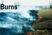
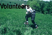
In all areas other than rental fields (i.e. idle exotic domestic grass, reconstructed prairie, regenerating prairie / savanna, and remnant prairie / savanna) prescribed fire has been and probably shall be the primary management method. Burn units range from less than 0.1 to 190 acres in size, and their boundaries frequently are realigned (where possible) to provide a mosaic of fuel loadings and fire return intervals. Most burns are conducted in Spring but at least one unit is prepared for a Fall fire. We now are experimenting with growing season burns in small areas which have mixed cool-season exotic and warm-season native species. Fuel breaks are mowed (where possible) 20 - 25 feet wide, hay raked, and leaf blown (where needed). When within a 1 to 1 ratio (height to distance from edge) to the outer edge of a burn unit, snags are either protected with mini-breaks or felled and removed from the fuel break edge as is any significant deadfall. Ignition is done only with an adequate crew and under weather conditions appropriate for both safe control and also for carrying the fire into areas where its impact is needed. Nearly all burns are ignited as ring-fires, but closure of the upwind side may be delayed to allow maximal backing-fire both for increased impact on woody vegetation and to decrease mortality of terrestrial vertebrates. After the blackline is complete, only the largest skips within a unit are re-ignited.
Much of our management effort is directed toward fuel break improvement in brushy and timbered areas. Ideally our fuel breaks allow a 20 - 25 foot-wide mowed area on the outside of a burn unit. Also within the outer edge of the unit there should be another 20 - 25 foot-wide area of unmowed graminoid vegetation (for a blackline). Interior to this, the unit edge should contain few to no snags. Furthermore, to increase the efficiency of fire in timbered areas, we open up “burn bridges” (= “fire channels”) ideally equal in width to the height of adjacent trees; these burn bridges connect otherwise separate areas of graminoid fuels. As time allows, to increase the pace of our restoration efforts, we also may clear larger areas of invading woody vegetation. Additionally, line and road fences must be cleared of most woody growth not only to increase the longevity of the fences, but also because these features must serve as burn unit edges or fuel breaks. All of these activities require felling of unwanted trees, snags, and brush with chain and clearing saws. Some firewood is salvaged from our cutting but most slash is brush-piled or placed in ditches in attempts to construct artificial debris dams. To prevent unwanted fire spread, brush piles which are too close to the edge of a burn unit are burned separately when there is adequate snow cover. New slash may be disposed of as it is cut on burning brush piles or simply burned as it is cut when clearing within an already blacked-off burn unit. Large snags shall be left standing for habitat when they are neither hazards during prescribed fires nor generators of too much shade.
Invasive and ecologically undesirable woody vegetation also is being cleared from selected areas within burn units. The below listed species of trees and shrubs are being cut and burned as described in the above paragraph or their slash is being scattered (but only if adequately distant from the fuel breaks at unit edges). A few larger trees are girdled and left to stand as snags for habitat. Appropriate herbicides (e.g. Pathfinder II RTU ®) may be used to treat stumps, frill girdles, or as a basal bark treatment. These problem species include, but are not limited to:
- Siberian Elm, Ulmus pumila - an invasive exotic tree.
- Osage Orange, Maclura pomifera - an invasive tree native to North America but not Iowa.
- Box Elder, Acer negundo - a tree native to Iowa but invasive and ecologically undesirable (on uplands and side slopes).
- Honey Locust, Gleditsia triacanthos - a tree native to Iowa but invasive and ecologically undesirable (on uplands and side slopes).
- woody Honeysuckle species like Lonicera maackii - an invasive exotic shrub to small tree.
- Autumn Olive, Elaeagnus umbellata - an invasive exotic shrub to small tree.
- Multiflora Rose, Rosa multiflora - an invasive exotic shrub.
- Rough Dogwood, Cornus drummondii - an invasive native shrub to small tree.
- Smooth Sumac, Rhus glabra - an invasive native shrub to small tree.
Regrowth of woody species and thick bramble patches (Blackberry, Rubus species) are controlled mostly by our prescribed fires. In the years between burns and where there is inadequate fuel to carry fire, we may treat these by mowing either with a clearing saw or a tractor-mounted rotary brush mower. Regrowth also may be treated by foliar application of appropriate herbicides like RoundUp ® (for most species) or Stinger ® (for Honey Locust).
Selected herbaceous weeds, mostly exotic introductions, are being treated with a variety of methods both chemical and mechanical:
- Canada Thistle, Cirsium arvense - when patches of this clonal, perennial species are located, they are mapped, marked with flags, annually mowed, and then spot sprayed with Stinger ® when adequately regrown. This treatment cycle is repeated until no shoots are found for at least two consecutive growing seasons.
- Crown Vetch, Coronilla varia - spot treated by us or by a commercial applicator with Stinger ® as time and our renter’s rotational grazing system allows.
- Common Burdock, Arctium minus - good control in most places by competition and prescribed fire. However, relatively thick or persistent patches may be treated mechanically (rotary mowing or cutting off just below the crown with a tile spade) or spot treated with Stinger ® in the “rosette” stage.
- Musk Thistle, Carduus nutans - thick patches have been rotary mowed and isolated plants have been dug (greatest impact when just beginning to flower). However the necessity of treating this listed noxious weed has been greatly reduced by the recent invasion of an exotic “flowerhead weevil” (possibly Rhinocyllus conicus); the unplanned spread of this biological control agent has greatly suppressed reproduction of Musk Thistle. Unfortunately, since the genus Cirsium also is known to serve as a host species (Louda et al., 1997; Strong, 1997), this invasion may have a negative impact on our small population of the Iowa-listed as threatened Hill’s Thistle, Cirsium hillii, which blooms at about the same time as Musk Thistle.
- Garlic Mustard, Alliaria petiolata - control attempted in only a few selected areas where trees are planned to be retained (oak woodland, savanna). Mostly we pull bolting (2nd year) plants; we have done a little experimentation with cooking 1st year plants with a “weed burner.”
- Wild Parsnip, Pastinaca sativa; White & Yellow Sweet Clover, Melilotus alba & M. officinalis; Poison Hemlock, Conium maculatum; Common Mullein, Verbascum thapsus - control attempted in only a few selected areas by pulling, cutting off just below the crown, or rotary mowing of bolting plants.
- Chinese Bushclover (= Serecia Lespedeza), Lespedeza cuneata; Field Garlic, Allium vineale - all plants found in all infestations are dug up and disposed of in burn piles or with garbage.
- Bird’s-Foot Trefoil, Lotus corniculatus - initiated experimental treatment in 2004 by spot spraying with Stinger ® as time allows. Probably best to treat regrowing crowns after our prescribed burns.
- Giant Ragweed, Ambrosia trifida - when thick, self-perpetuating patches of this native species have proven to be a problem, we control by rotary mowing in mid-Summer.
Almost 100 other exotic species are known to spontaneously occur at Indiangrass Hills (see Appendix A-1, Plant Inventory at Indiangrass Hills). Most are herbaceous, and some are strongly invasive (even some species such as Smooth Brome and Tall Fescue which may be planted for forage crop renovation!). Although prescribed fire has a beneficial impact by reducing the vigor of the populations of many of these species, some such as exotic, probably hybrid, Reed Canary Grass, Phalaris arundinacea (which undoubtedly was planted by former owners in some waterways) are a serious problem. We must develop other effective control strategies for the seriously invasive weeds and specifically tailor each strategy for individual species.
We plan to harvest seed from our own prairie remnants for use in reconstruction of Type B areas. Indeed, we already harvest a small quantity of selected species each year either by hand or with a hand-held seed stripper. Before the harvest can be increasingly mechanized, we must clear brush, trees, stumps, deadfall, large rocks, and the remains of decayed interior fence from the prairie remnants. Eventually we plan to either harvest with a small combine or by cutting prairie hay to roll out in areas to be reconstructed.
For reconstruction of an area to prairie / savanna, local sources of seed or other propagules are strongly preferred. If unable to harvest an adequate quantity from our own remnant prairie areas, only known-source, Iowa-derived seed shall be planted. Accurate records shall be kept of when, where, what species, and how they were introduced to Indiangrass Hills. Native species may be established in a reconstruction by any combination techniques of including but not limited to the following:
- row-cropping of target area (generally the higher fertility soil where less subject to erosion) for not more than three (3) years to kill exotic species and reduce weed pressure from the seed bank.
- No more than 20 acres (of the entire 640 acres of Indiangrass Hills) shall be row-cropped in any one year.
- herbicide application to reduce competition from exotic species.
- seeding or overseeding of native species by broadcasting, drilling, etc.
- mowing or haying.
- grazing in an appropriate manner.
- prescribed fire.
Although prescribed fire has been our preferred large-area management technique, it is a method which can have a deleterious impact on many invertebrate and terrestrial vertebrate species. Three supplemental alternatives to fire presently are known to us: mowing, haying, and grazing.
Mowing is not a viable strategy for long-term use over large areas because it is both too time-consumptive and also leaves a smothering “thatch” of chopped debris on the ground. Nonetheless, it may be used as a special application during the early establishment phase of a reconstruction and for brush or weed control in small areas.
Hay harvest is a somewhat better strategy because it removes the cut “thatch” from the treated area. However, the low cutting height required for haying necessitates moderately smooth ground and the removal of such obstacles as stumps or rocks to prevent equipment damage and allow efficient raking into windrows for baling. Modest capital investment in a suitable hay mower and small square bailer also would be required. If the hay were harvested as a forage crop at the proper time during the growing season, this technique could have a beneficial impact by altering competition between cool- and warm-season species to suppress the generally cool-season exotic species. We currently are having a neighbor harvest small areas to experiment with this procedure. If native hay were cut in late Fall / early Winter, it would have low nutrient value but would contain many undispersed seeds and could be used as a seeding resource for prairie reconstruction.
Grazing by domestic stock is the most viable and “natural” process with which to supplement our prescribed fire regime. Not only is biomass that would produce thatch reduced, but also a varying vegetation height “structure” would be developed which benefits a diverse assemblage of grassland birds. Neither mowing nor haying produces this desirable structure to the vegetation. Furthermore, appropriately timed and stocked grazing events also should have a beneficial impact not only by altering competitive advantage between cool- and warm-season species, but also by favoring seasonally less palatable species. Surprisingly it has been documented in at least one instance that these less palatable species are many of the forbs which otherwise decrease under heavy, season-long grazing pressure (Helzer, 2004). Control of the particular area grazed, timing, and stocking rates could be achieved best with some rotational grazing system, but perhaps could also adequately be controlled with either flash grazing or a patch burn and graze system.
Unfortunately three factors prevent near-term implementation of grazing as a supplemental management system: 1) A heavy capital investment in infrastructure would be needed to secure perimeter fence, erect fireproof paddock fencing, and install an adequate water system. 2) A considerable investment of time would be required to plan a beneficial grazing system, design the layout of the infrastructure, clear trees and brush for interior fencing, and install the infrastructure. 3) Since we know little about managing livestock, a reasonable lease would have to be negotiated with a compatible renter. Furthermore, the paddock fencing must exclude livestock from all major ditches, wetlands, and ponds.
Heavy infestations of invasive species (such as Garlic Mustard) could possibly be controlled by the intentional introduction of species-specific biological agents. Whether these hypothetical bio-control species were native or exotic, we might chose to use the biological agents to treat problem weed species. However, we would employ such agents only if we were sufficiently convinced that the benefit of their release greatly exceeded the risks involved. For example, see discussion of the deleterious impact of the introduction of the flowerhead weevil (for bio-control of Musk Thistle) in Louda et al., 1997 and Strong, 1997.
Supplemental funding or income production may be sought through farm, wildlife habitat, or conservation programs offered by federal (e.g. NRCS, FSA, F&WS), state (e.g. DNR, SWCD), and private (e.g. Iowa Prairie Network) organizations.
Other Management IssuesSeveral plant and animal species of conservation concern (listed, declining, or uncommon in Iowa) are known to occur at Indiangrass Hills (see Appendix C, List of Species of Conservation Concern found at Indiangrass Hills), and others may yet be documented. Our management procedures will not be designed to benefit only one or even several of these species, but rather shall be designed to maintain, rehabilitate, and reconstruct the grassland / savanna habitat on which most depend.
Turkey Vultures nested for several years in the decaying barn on the Buss 160 and also frequent Indiangrass Hills. Each year we have our tenant place one or two carcasses of farm animals (should any die) in an out-of-the-way location as food for these fascinating birds.
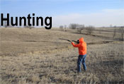
Hunting (but not the use of traps or snares) is allowed but restricted to game species with large populations. These species presently (2005) include white-tailed deer (preferably does), pheasant, raccoon, and cottontail rabbit. No fee is charged for hunting, but all hunters (and accompanying non-hunters) are required to get written permission (renewed annually) to enter Indiangrass Hills to hunt. Gates, field entrances, road fences, and line fences are posted with 12” x 8” signs (see photocopy Fig. 3) notifying the public of this requirement.
The structures which retain existing and future water bodies will require periodic maintenance to preserve their functionality. At present (2005) we have two (2) farm ponds (1 on Buss 160, 1 on R/F/B 480), two (2) grade stabilization structures (both on Buss 160), and four (4) wetland dams with control structures (2 on Buss 160, 2 on R/F/B 480).
Most waterways, regardless of size, contain a steep-walled channel along all or part of their length. Some cut banks in the larger valleys clearly reveal that overbank sedimentation of soil eroded from the uplands has produced this geometry since Euro-American settlement. However, in shallow draws in upland positions, these channels seem largely erosional. Natural processes generally will be allowed to heal most gullies and ditches over the long term. Stock shall be fenced out of as many waterways as possible. Artificial manipulation of ditches and gullies has been and may be attempted in some cases. This manipulation may involve shallowing the banks by removal of dirt (spread elsewhere); filling of the channel with dirt, rip-rap, or rubble; installation of artificial debris dams made of slash from clearing woody vegetation; construction of erosion control structures with piped outlets, etc. Ditch and stream crossings may require special treatment both for line fences and temporary or permanent access lanes. The deep and difficult to cross, main ditch on the Buss 160 has had a culvert installed by a prior owner; this aging access structure must be maintained to allow us to burn safely.
A worthwhile, but long-term and very costly project would be the excavation and recovery of the valley head slough in the northwest quarter of Section 20 (see last paragraph of Part 1.2). Although deeply buried by overbank sedimentation, this slough may be restorable. Suggestively, when the two grade stabilization structures were installed on the Buss 160 within the area formerly occupied in the 1840's by this slough, sprouts of two wetland species (Alisma subcordatum, southern water plantain and Sagittaria sp., an arrow-head) appeared as soon as there was standing water in the tiny pools. These two species do not occur elsewhere at Indiangrass Hills in any other water feature, either existing when purchased or newly constructed by us. They most likely sprouted from the historic seed bank of this slough. Furthermore, the north grade stabilization structure exhibits anomalously high water next to the dam suggesting that a “spring” may rise from the slough sediment in this area. Of course, this project would have to be well-planned and be based on a network of shallow drill holes to determine the extent of the buried slough deposits (and thus the geometry of restorable slough itself).
Other small unnatural topographic irregularities mar Indiangrass Hills. These include such features as entrenched cow paths, dozer piles and gouges from brute-force clearing, entrenched equipment tracks, old basement holes, etc. Most of the larger of these eventually will be roughly leveled to conform to the immediately surrounding landscape.
To control erosion in large disturbed areas or during establishment of prairie plantings, we may sow exotic annual or perennial species as cover crops.
A remarkably small (but not insignificant) amount of metal and other junk is stashed in draws or abandoned elsewhere on the project area. This junk slowly is being removed for proper disposal or recycling. Obsolete interior and worn out line fence is being removed or replaced as time allows; material is salvaged for reuse when possible and unuseable wire, etc. may be recycled (preferred alternative) or buried on-site.
Existing buildings may be repaired for use, allowed to continue decaying as only animal habitat, or may be razed and the debris burned or buried on-site. Their footings, slabs, or foundations, and those of other long-gone structures, eventually may be salvaged as rubble fill to stabilize selected ditch segments.
Compatible Non-Management ActivitiesBoth we and our permitted guests may engage in the below listed activities:
- Harvest of wild fruits, nuts, and mushrooms.
- Low-impact tent camping, picnicking, and camp fires.
- Botanizing, bird-watching, and wildlife observation.
- Hiking and walking both on lanes and cross country.
- Non-motorized winter recreation such as skating, skiing, and sledding.
- Horse-back riding (but organized “trail ride” events are NOT allowed).
- Scouting for game outside of hunting seasons.
- Exercising both pet and hunting dogs (but organized hunting dog trial events NOT allowed).
- Training events for emergency responders (e.g. rescue dog handlers, volunteer fire departments).
- Salvage of firewood or wood chips from restoration activities.
- Scientific research projects on the natural history of our project area by qualified parties.
-
Indiangrass Hills has so far been used for parts of three such studies:
- An undergraduate research paper using some of our populations of Grooved Yellow Flax (Linum sulcatum). Prepared for the Department of Biology, Grinnell College, Grinnell, Iowa by Emily Mohl (2000).
- An undergraduate thesis using some of our prairie remnants to compare two collection techniques for bees. Prepared for and accepted as an Honors thesis in the Department of Environmental Sciences, The University of Iowa, Iowa City, Iowa by Keith Gaddis (2004).
- A PhD dissertation studying first order fire effects, characteristics, and behavior which uses an instrumented grassfire at Indiangrass Hills. In preparation for the Geoscience Department, The University of Iowa, Iowa City, Iowa by Mary E. Lata (in prep. 2005).
- Field trips approved by us and sponsored by qualified organizations.
- Other non-motorized activities not in conflict with the conservation values of our grassland / savanna restoration.
The Indiangrass Hills prairie / savanna restoration project in Pilot Township, Iowa County, Iowa, has been underway since the Spring of 1997. The season-long grazing and continuous row-crop cultivation practiced over much of the property by former owners has been discontinued, and more conservation-oriented agricultural and ecological management techniques implemented. Substantial progress has been made (using prescribed fire together with clearing of trees and brush) in the rehabilitation of existing remnant and naturally-regenerating prairie resources. Both prairie plant species and native grassland birds, including species of conservation concern, have responded well to this effort. Minor reconstruction of prairie has started in selected areas mostly using local source seeds. Given the magnitude of restoring 640 acres with limited resources, we must take a long term view toward this project. We thus present no fixed timetable for our actions but rather have above prioritized (see Parts 2 and 3) our management activities by the problems and promises in each definable unit of existing vegetation. Unfortunately, income must be generated by our project for its partial support, so temporary or permanent agricultural uses of a compatible and conservation-oriented nature must be factored into our management mix.
We are gratified to have made considerable progress in so short a time with our limited resources at Indiangrass Hills. Furthermore, we believe that our project demonstrates that there is a significant, neglected resource for native prairie biodiversity in the permanent pastures and brush- and timber-infested back-forties of many of Iowa’s farms, especially those farms with rough ground and low fertility soils.
References Cited- Andreas, A.T., 1875. A.T. Andreas’ Illustrated Historical Atlas of the State of Iowa. The Lakeside Press, Chicago IL, vii + “557" pp. [Note that pagination irregular with missing pages, duplicated page numbers, fractional page numbers, & many unnumbered pages; examined copy was that for the Seventh Congressional District.]
- Anonymous, 1881. The History of Iowa County Iowa Containing: A History of the County, its Cities, Towns, &c., ... Union Historical Company, Birdsall, Williams & Co, Des Moines IA, vi + 1 plate + 7-774 pp. Reprinted 1982 under sponsorship of the Iowa County Historical Society, Marengo IA; printed by Walsworth Publishing Company, Marceline MO, with new [replacement?] page for “copyright” page + new unnumbered 63 page genealogical index at end.
- Dodds, J.S., et al. editors, 1943. Original Instructions Governing Public Land Surveys of Iowa: A Guide to their Use in Resurveys of Public Land. Iowa Engineering Society, Ames IA (printed by Powers Press, Ames IA), xiv + 2 unnumbered pages + 1 unnumbered plate between pp. 145 & 146 + 565 pp.
- Easterly, Nathan W., 1951. The Flora of Iowa County. Iowa Academy of Science, Proceedings [for 1951], 58:71-95
- Eilers, Lawrence J., & Dean M. Roosa, 1994. The Vascular Plants of Iowa. University of Iowa Press, Iowa City IA, xi + 304 pp.
- Gaddis, Keith, 2004. “Effectiveness of Two Collection Techniques for Hymenoptera: Apoidea.” An undergraduate Honors thesis for the Department of Environmental Sciences, The University of Iowa, Iowa City, Iowa: 28 pp.
- Gleason, Henry A., & Arthur Cronquist, 1991. Manual of Vascular Plants of Northeastern United States Adjacent Canada, 2nd Edition. 2nd printing 1993 [with undocumented corrections]. New York Botanical Garden, Bronx NY, lxxv + 910 pp.
- Gorsh, Alfred, 2000. Oral communication 26 April 2000. Mr. Alfred Gorsh was a life-long resident of the area; he died in Spring 2001.
- Helzer, Chris, 2004. Big Ugly Cows Might Help Keep Prairies Beautiful [abstract of oral presentation]. Pp. 39-40 in 19th North American Prairie Conference, Final Program [with abstracts], August 8-12, 2004, University of Wisconsin - Madison, Madison WI, 72 pp.
- Highland, J.D. and R.I. Dideriksen, 1967. Soil Survey of Iowa County, Iowa. US Department of Agriculture, Soil Conservation Service, i + 162 pp. + 2 unnumbered tables + 3 unnumbered maps + 3 unnumbered legends + [map] Sheets 1-96. Including an anonymously authored, undated, hand numbered, photocopied 5 page Supplement listing the CSR (= Corn Suitability Rating) of each soil map unit. Note that a new soil survey is in preparation and due for distribution in 2005.
- Hutchison, Max, 1988. A Guide to Understanding, Interpreting, and Using the Public Land Survey Field Notes in Illinois. Natural Areas Journal, 8(4):245-255.
- Iowa Executive Council, 1875. Thirteenth State Census: The Census of Iowa, as Returned in the year 1875, Showing ... R.P. Clarkson, State Printer, Des Moines IA, xv + 507 pp. Document examined http://name.umbl.umich.edu/ajb5499 at Humanities Text Initiative web site http://www.hti.umich.edu.
- Lata, Mary E., in prep. 2005. “Variables Affecting First Order Fire Effects, Characteristics, and Behavior in Experimental and Prescribed Fires in Mixed and Tallgrass Prairie.” PhD dissertation, Geoscience Department, The University of Iowa, Iowa City, Iowa: ??? pp.
- Louda, S.M., et al., 1997. Ecological Effects of an Insect Introduced for the Biological Control of Weeds. Science, 277(5329):1088-1090.
- Mohl, Emily, 2000. “Character Variation and Geographic Distribution of Linum sulcatum (Linaceae) and Linum rigidum: An Analysis Based on Competition Theory.” An undergraduate research paper for the Department of Biology, Grinnell College, Grinnell, Iowa: 15 pp. + 6 unnumbered pages.
- Sage, Leland L., 1974. A History of Iowa. Iowa State University Press, xii + 376 pp.
- Stein, John, Denise Binion, and Robert Acciavatti, 2003. Field Guide to Native Oak Species of Eastern North America. US Department of Agriculture, Forest Service, Forest Health Technology Enterprise Team, Technology Transfer, vi +161 pp. + 4 unnumbered pages (1 foldout). [Publication] FHTET-2003-01.
- Strong, D.R., 1997. Fear No Weevil?. Science, 277(5329):1058-1059.
- Unknown, 1845. [Hand drawn transcription of original plat maps surveyed by Deputy Surveyors J.E. Whitcher, May 1843, & John Senter, November 1844, for] “Township No. 79 N. Range No. 11 West 5th Mer:, Dec 9 with S.G. letter of Feby 1845" and three page handwritten tabular summary surveyors’ notes. Photocopy provided by Christine Taliga, circa 1999, source unknown.
- Unknown, 193?. [Typed transcription of original notes by Deputy Surveyor John Senter, sworn 29 Nov 1844, for] “Subdivisions of Township No. 79 N. of Range No. 11 West of the 5th. Prin Mer. Iowa Territory. Commenced Nov 21st. and completed Nov 23rd. 1844.” Photocopy of township map and “pp. 300-364" provided by Christine Taliga, circa 1999, source unknown.
- Introduction
- Setting
- Vegetation and Management
Unit - Agricultural Management
Methods - Present Ecological Vegetation
Management Methods - Future Ecological Vegetation
Management Methods - Other Management Issues
- Compatible Non-Management Activities
- References Cited